
Seven Deforestation-monitoring Tools That Can Support Compliance with the EUDR
- Gusi Ayu Putri Chandrika Sari
- Jul 24, 2023
- 2 min read
Updated: Sep 23, 2024
Digitalcoffeefuture.com (Jul 4, 2023) - Following the recent approval of the European Union Deforestation-Free Products Regulation (EUDR) by the European Council on May 19th, the coffee industry is now faced with the imperative of adopting digital tools to ensure compliance with this new regulatory framework. Although, according to the World Economic Forum, there remains some skepticism on the practical implementation of EUDR and its ability to consistently discern deforestation risks across various geographic regions, mandatory geographic information system (GIS) information in the form of GPS points or polygons, together with product traceability, is now required. This urgency has prompted companies to seek a clear understanding of how to approach digitalization and identify suitable tech providers or service solutions that align with their specific requirements.

In the previous article titled "Digitalization for compliance with the new EU regulation on deforestation-free products," we anticipated the general requirements for coffee companies to integrate digitalization and highlighted the complexities involved in collecting geolocation and traceability data. In this article, we present a small selection of examples among the wide range of tools catering to diverse user needs and operating contexts to demonstrate the possibilities in this context.
KoltiTrace Highlighted Among Seven Deforestation-Monitoring Tools That Aid Compliance with the EUDR

Koltiva is an Indonesia-based agritech company that integrates technology solutions with boots-on-the-ground professional service to make global supply chains traceable, inclusive, and climate-smart. One of their offerings is the KoltiTrace MIS (Management Information System), which serves as a comprehensive platform combining bottom-up and top-down datasets, providing important information about various agricultural operations.
Field supply chain actors, such as farmers, input providers, traders, and extension officers collect data directly on the ground using mobile devices, including geolocation of farms, farmer contact information and consent, and other relevant details.
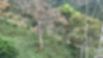
On top of that, Koltiva integrates top-down datasets, such as geospatial data on forest coverage, deforestation, and protected areas. The system employs AI techniques such as deep learning and machine learning to process data from satellites like Landsat-8 and Sentinel-2. The acquired satellite and third-party data undergo spatial data processing to extract relevant information, which is then analyzed on the KoltiTrace MIS dashboard.


By cross-referencing geospatial data with the dataset collected on the ground, the systems can identify the intersecting areas between forests, tree cover loss, and specific farm types, verifying commodity-specific deforestation occurrences. KoltiTrace integrates the collection and analysis of data with complex requirements, enabling efficient documentation for Due Diligence processes.
Target customers: Agri input providers, farmers, agribusinesses, traders, manufacturers, retailers, civil society organizations, and governments.
Languages available: English, Spanish, Portuguese, French, Chinese, Thai, Vietnamese, Indonesian, and can be translated on demand into any language with a standardized orthography.
Support for customers to learn how to use the platform: KoltiTrace offers manuals, videos, and direct user training via Koltiva's Customer Success Officers in various local languages and local offices are available to offer additional direct support.

This article is adapted from Digital Coffee Future Magazine, published date: Jul 4, 2023


